

Services
Empowering Your Business with Space
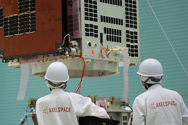
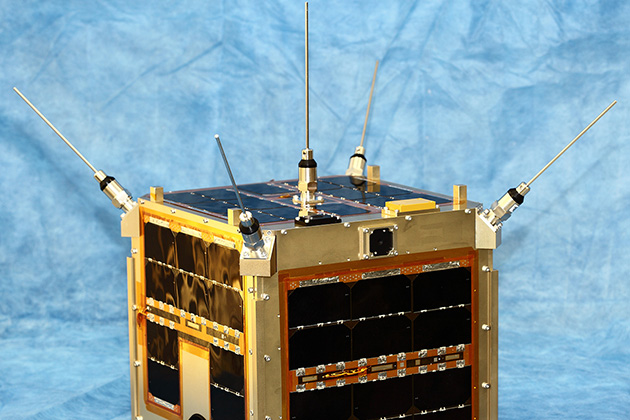
Axelspace has developed and operated 11 microsatellites in
orbit. Our solutions, AxelGlobe and AxelLiner, build on this
proven track record to offer robust support for our
customers’ utilization of space in their businesses.
AxelGlobe
is an Earth observation platform that offers business
insights for various applications, including agriculture,
news reporting, disaster and environmental monitoring, by
offering satellite-acquired data.
AxelLiner delivers a one-stop service for microsatellite projects to our customers. The service enables customers to actualize their in-orbit demonstration and satellite-based services by owning their own satellites or installing their mission equipment to AxelLiner satellites.


AxelGlobe
Space Perspectives for Business Innovation
Utilize
AxelGlobe satellites as a new set of “eyes” to
see your business. Unlike ground-based
observation, satellites offer unrestricted
geographical coverage and the ability to
monitor vast areas repeatedly. This enables
customers to understand current conditions and
visualize qualitative and quantitative changes
that are otherwise challenging to observe. The
satellite data, analyzed by advanced
processing technology and AI, provides
customers with unique insights that address
various needs, such as enhancing business
efficiency and informing strategic planning.
Various Examples of Satellite Data Application
Smart Farming
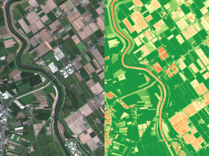
Periodic satellite observations provide comprehensive monitoring of vast farmlands, significantly reducing the amount of time and effort required for manual management. Analyzing satellite data supports the understanding of crop growth conditions, targeted pest control, precise fertilizer application, and accurate predictions of harvest quantities and timings, thereby improving operational efficiency.
AXELGLOBE - 01
News Reporting
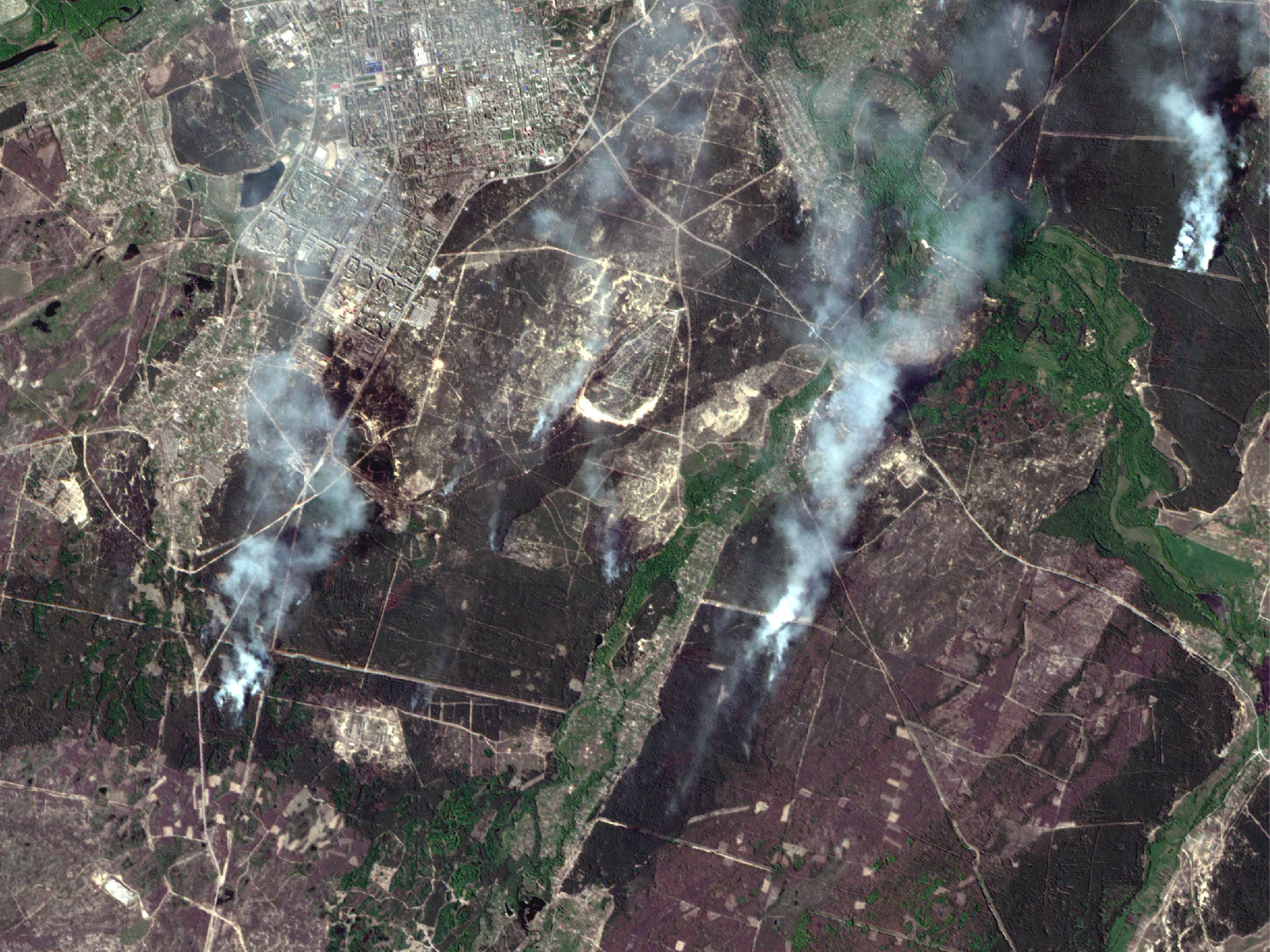
Satellites can capture wide areas with minimal geographical constraints, making it possible to gather factual information from remote locations, disaster or conflict zones, and other places where human access is restricted, in addition to detecting changes not visible from the ground. This facilitates reporting based on highly reliable and unique information. The provided capturing rights allow users to specify the area and timing without purchasing images beforehand, ensuring efficient and targeted acquisition of only the necessary images.
AXELGLOBE - 02
Infrastructure Management
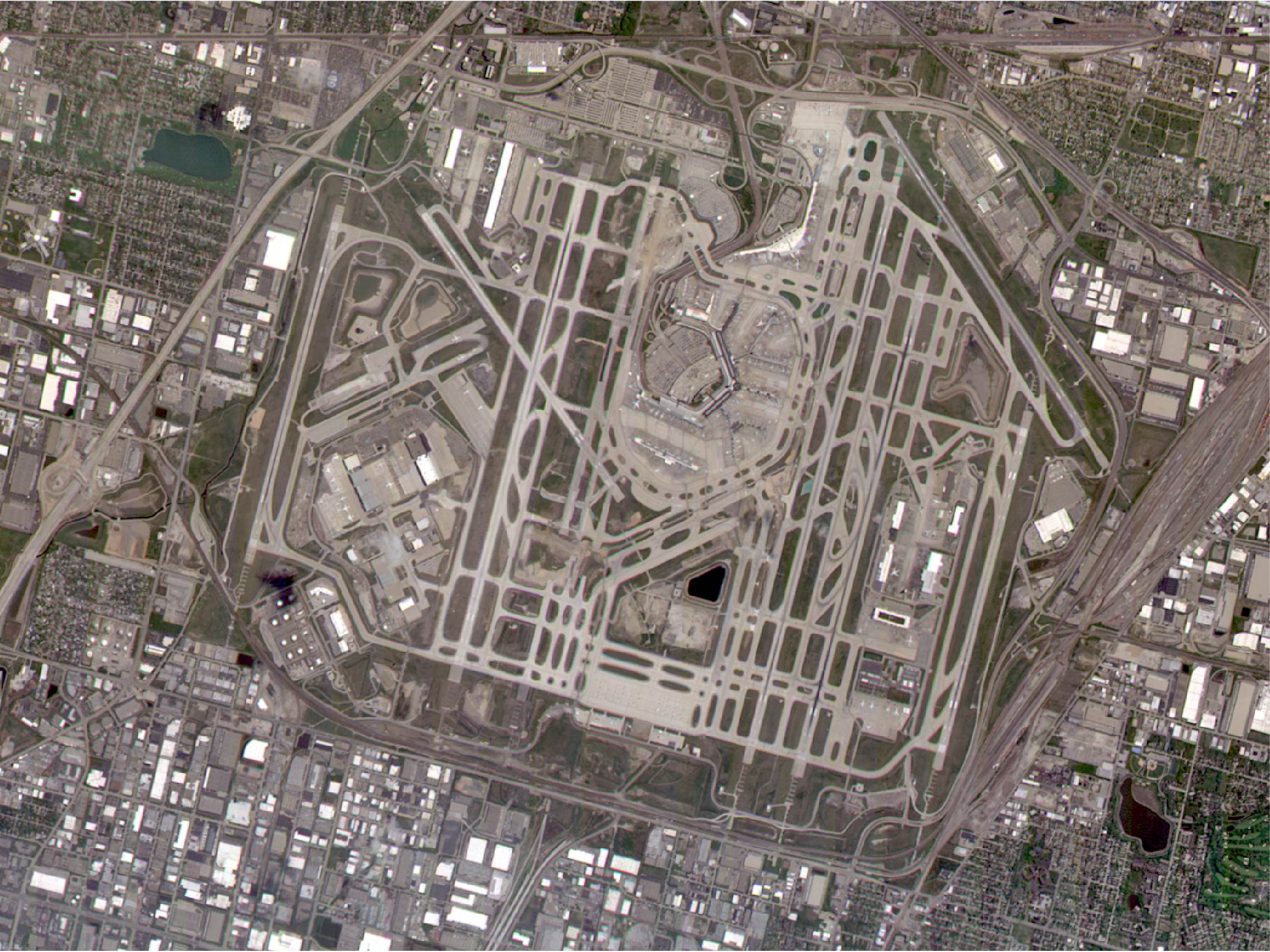
Fixed-point observation using satellites streamlines the maintenance for infrastructure such as oil and gas facilities, pipelines, dams, power plants, ports, and airports. It also ensures safe monitoring of hazardous areas, such as accident sites and high-risk locations. Additionally, satellite data analysis provides insights into the conditions and changes of targets that are challenging to observe from the ground.
AXELGLOBE - 03
Land Management
Frequent satellite observations aid in the monitoring of roads, buildings, land, coastlines, as well as map creation, updates, and urban development. Image data screening identifies significant changes, allowing for the efficient pinpointing of areas needing updates or attention within large regions. Combining multiple image datasets also enables the delivery of cloud-free images.
AXELGLOBE - 04
Space Situational Awareness
AxelGlobe satellites do more than observe the ground; they leverage advanced attitude control capabilities to capture images of space objects, including space debris, satellites, and the space station. This monitoring helps to keep track of the latest conditions in the space environment, aiding in the prevention of collisions and accidents.
AXELGLOBE - 05
Forest Management
Assessing the status of forests for
conservation and forestry typically
requires significant time and effort.
However, satellite observation
and data analysis of land cover can
effectively monitor tree growth and
changes in forest size. This helps
detect unexpected events like forest
fires and illegal logging safely and
effectively.
AXELGLOBE - 06
Environmental Monitoring

As the global demand for addressing ESG (Environmental, Social, and Corporate Governance) issues grows, the disclosure of non-financial information is becoming increasingly important for companies. Utilizing satellites enables the presentation of environmental protection activities, such as afforestation, with more objective data.
AXELGLOBE - 07
Finance and Insurance
The ability to acquire and utilize unique alternative data, including improving the accuracy of investment, demand, and supply-demand forecasts, is becoming increasingly critical for companies. Analyzing satellite data allows for the rapid understanding of information related to production and logistics, including the global supply chain, thereby enhancing business competitiveness.
AXELGLOBE - 08
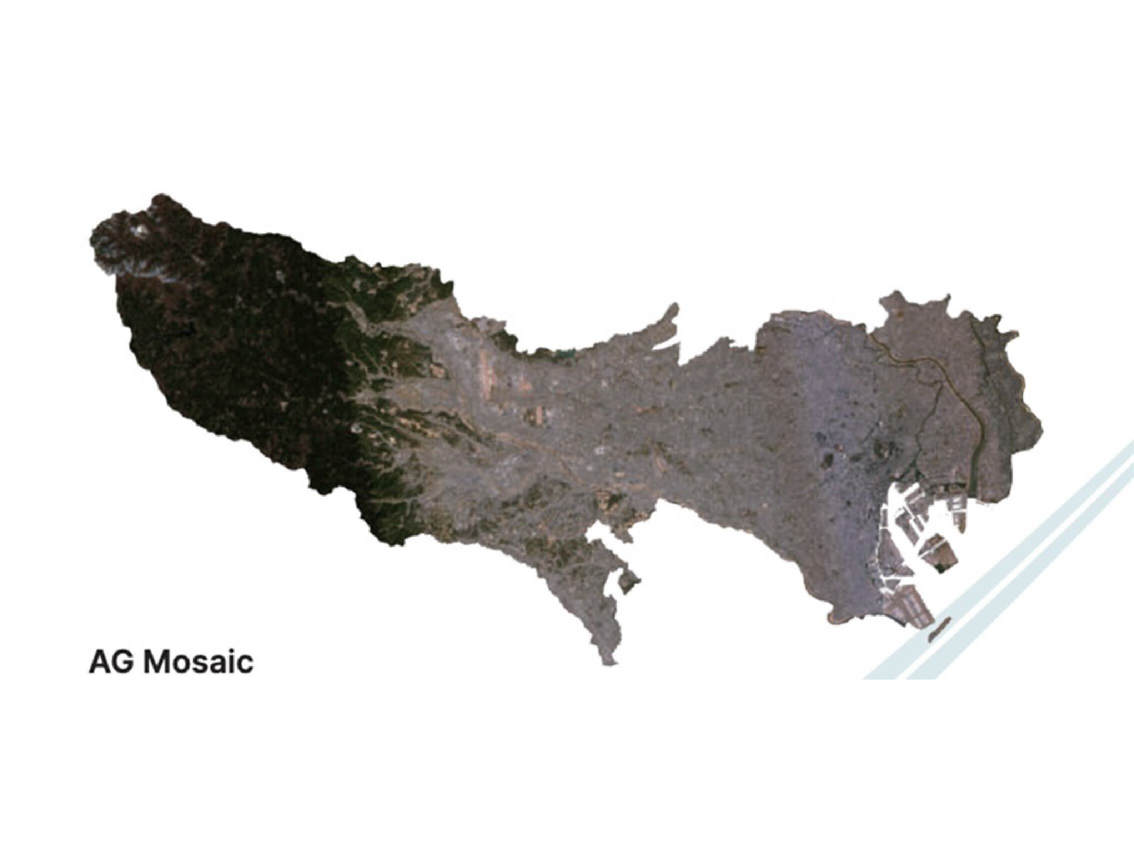
Customer Feedback
AxelGlobe serves over 30 countries through more
than 70 partners. Notably, it assists the
Geospatial Information Authority of Japan in
maintaining the Basic Electronic National Land
Map, the foundation for all Japanese maps.
Here
are some of the feedback from our customers.
Field of Data Application: Smart Agriculture
Often, satellite imagery companies can
either do high resolution over small
areas or medium resolution over very
large areas. This is where the
AxelGlobe service is different.
We
had several projects where we needed
very large areas captured (15,000km2),
at high resolution, with regular
cadence. We were very happy with the
quality of the AxelGlobe data, as it
included a Red-Edge band for our
agricultural application. API
integration meant seamless delivery to
our users through our software
platform. Our customers were also
happy with the turnaround times of the
data, allowing them to use it for real
time decision making.
AXELGLOBE - 01
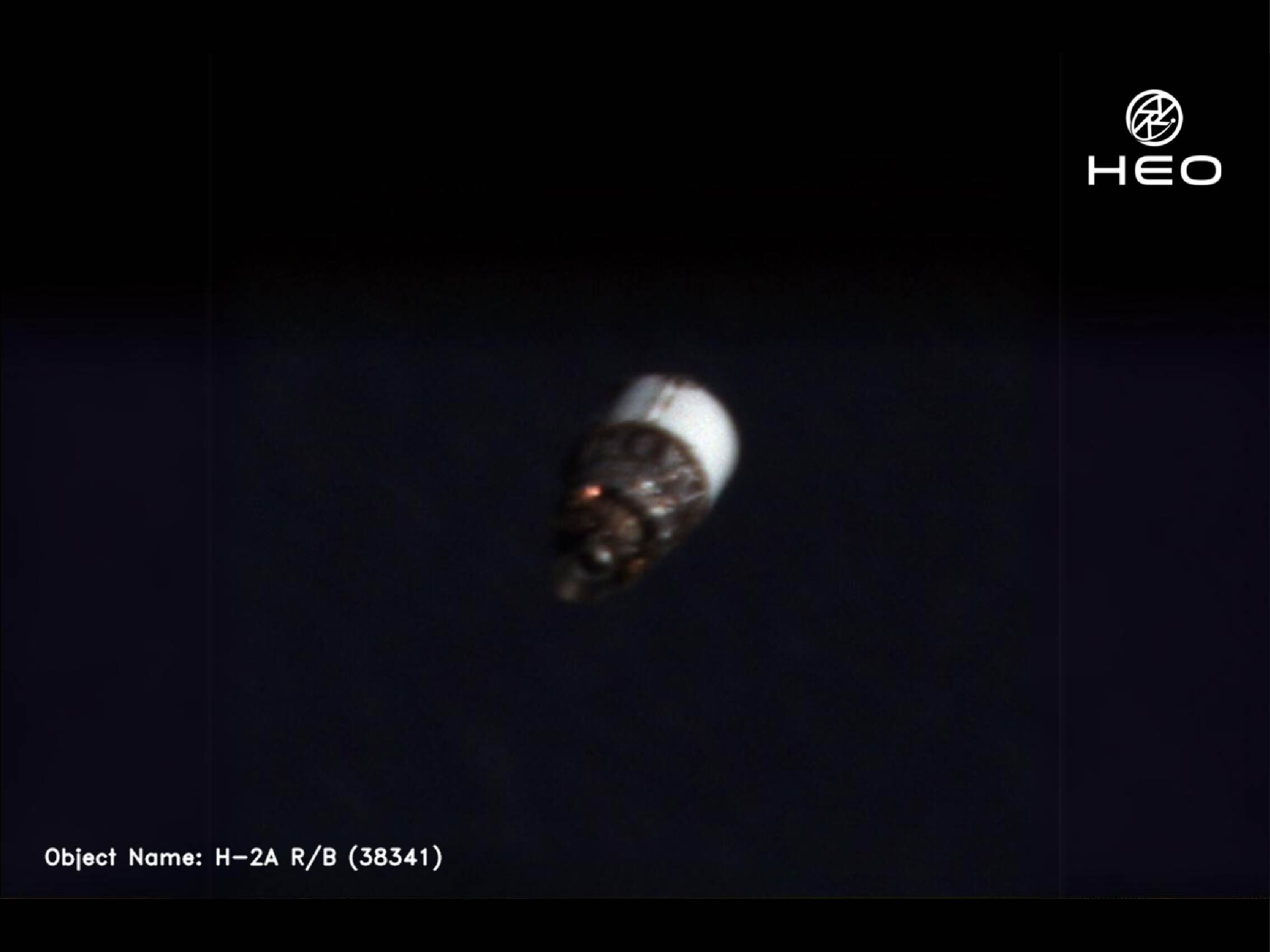
Field of Data Application: Space Situational Awareness
To take high-quality images of
satellites in space from orbit, HEO
requires a large network of satellites
that have high-resolution sensors
onboard. Partnering with AxelGlobe
allows HEO to be able to quickly image
satellites in space and apply our
analytics to solve challenges in
space.
AxelGlobe’s team of
innovators were the first of our
providers to implement high off nadir
angles to their satellites, which
allowed HEO to expand our coverage of
in-space objects and increase the
quality and number of images we take
per month.
AXELGLOBE - 02
One-stop service for microsatellite projects
This solution is designed to quickly respond
to the increasing demand from customers who
wish to offer services and conduct missions
using microsatellites in space.
Traditionally,
space missions have required a high level of
expertise and have posed significant risks in
terms of cost and lead time, limiting them to
only a few specialized operators.
To
enable more customers to realize their
services and missions in space, we have
packaged our microsatellite development
knowledge and achievements into a
comprehensive solution. Through this service,
customers can expand their business operations
in space and conduct technological
demonstrations in the space environment.
AxelLiner Professional (AL Pro)

AL Pro is a one-stop solution for
customers who wish to deliver their
own microsatellite services.
By
utilizing AxelLiner Terminal (AL
Terminal), customers can input
necessary information related to the
service they wish to realize. AL
Terminal then provides feedback on the
required number of satellites, orbits,
costs, etc., supporting customers to
formulate their business plans.
AL
Terminal will continue to serve as an
interface throughout the entire
satellite project even after satellite
development begins. This enables
customers to conduct compatibility
tests between mission equipment and
satellite bus emulators, manage
project status, and oversee in-orbit
operations. *1
This service
is suitable for a wide range of
customers, including those who want to
start by verifying the costs and time
required to realize a satellite-based
service, those who are new to
satellite projects, and those who
already have a concrete operational
plan seeking for its quick
realization.
*1 Service under development
AXELLINER - 01
AxelLiner Laboratory (AL Lab)
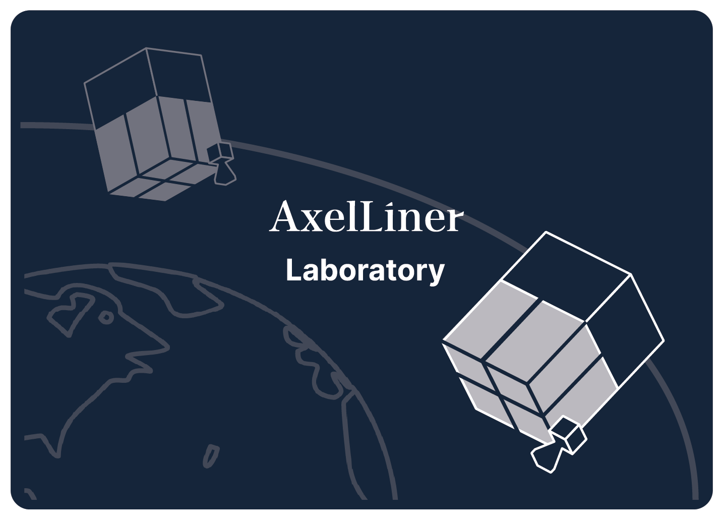
AL Lab provides in-orbit demonstration
opportunities to customers’ space
components and demonstration equipment
utilizing 100kg-class
microsatellites.
In this
service, customers can flexibly select
the launch timing according to the
development status of their
demonstration equipment. *2
Additionally,
it offers regular reviews of
customers’ in-orbit demonstration
results by leveraging our expertise in
satellite operations. Customers can
also benefit from our certification
system for demonstration results,
which can be used to support their
sales activities. *3
This
service can also be applied for
corporate promotions by bringing their
hardware to space, or for
entertainment-related services
utilizing unique features of space.
*2,3
Planned services
AXELLINER - 02
AxelLiner Service Flow: From Contract Signing to In-orbit Mission Implementation
-
Step - 01
Business Design
With AxelLiner Terminal, software provided by Axelspace, customers can easily and independently conduct business design from both a business and technical standpoint, including understanding estimated costs, schedules, and more.

Confirmation of Technical Feasibility
Once customers implement their business designs into AxelLiner Terminal, we will check technical feasibility of the project.
-
Step - 02
Development and Testing of Mission Equipment
An emulator that simulates a versatile satellite bus system enables customers to develop and test mission equipment on their own in an agile manner.

-
Step - 03

Satellite Assembly/Integration and System Testing
After assembling and integrating our versatile satellite bus system with the customer’s mission equipment, we will conduct coupling and comprehensive testing of the satellite system.
-
Step - 04

Procurement and Licensing
All necessary permissions and approvals as well as procurement for the satellite project are provided as a part of AxelLiner’s one-stop service.
Some of the necessary procurement and licensing includes, but not limited to, government permits and approvals, export control management, insurance procurement, arrangement of ground stations, and radio station license applications. -
Step - 05

Launch Arrangement
By determining how to appropriately put the satellite into orbit and fit into the schedule, the launch arrangement for the satellite will be performed as a part of AxelLiner service.
-
Step - 06
Mission Execution
Customers can focus on their mission operation by utilizing the simple automatic satellite operation system provided by AxelLiner.

Operation of Satellite Bus System
The automatic satellite operation system monitors the satellite conditions at all times, and the system performs collision avoidance operations when needed.
-
Step - 07

Mission Completion (De-orbit Operation)
Deorbit the satellite and prevent it from turning into space debris.


-
Step - 01
CustomerBusiness Design
With AxelLiner Terminal, software provided by Axelspace, customers can easily and independently conduct business design from both a business and technical standpoint, including understanding estimated costs, schedules, and more.
AxelspaceConfirmation of Technical Feasibility
Once customers implement their business designs into AxelLiner Terminal, we will check technical feasibility of the project.
-
Step - 02
CustomerDevelopment and Testing of Mission Equipment
An emulator that simulates a versatile satellite bus system enables customers to develop and test mission equipment on their own in an agile manner.
Axelspace -
Step - 03
CustomerAxelspaceSatellite Assembly/Integration and System Testing
After assembling and integrating our versatile satellite bus system with the customer’s mission equipment, we will conduct coupling and comprehensive testing of the satellite system.
-
Step - 04
CustomerAxelspaceProcurement and Licensing
All necessary permissions and approvals as well as procurement for the satellite project are provided as a part of AxelLiner’s one-stop service.
Some of the necessary procurement and licensing includes, but not limited to, government permits and approvals, export control management, insurance procurement, arrangement of ground stations, and radio station license applications. -
Step - 05
CustomerAxelspaceLaunch Arrangement
By determining how to appropriately put the satellite into orbit and fit into the schedule, the launch arrangement for the satellite will be performed as a part of AxelLiner service.
-
Step - 06
CustomerMission Execution
Customers can focus on their mission operation by utilizing the simple automatic satellite operation system provided by AxelLiner.
AxelspaceOperation of Satellite Bus System
The automatic satellite operation system monitors the satellite conditions at all times, and the system performs collision avoidance operations when needed.
-
Step - 07
CustomerAxelspaceMission Completion (De-orbit Operation)
Deorbit the satellite and prevent it from turning into space debris.
Axelspace’s Commitment to Sustainability
Redirect to our holdings company’s website (Axelspace Holdings Corporation).